


Top Spot Fishing and Recreation Maps
As low as
$22.99
Fishing Maps are waterproof and include freshwater, inshore saltwater and offshore saltwater areas. Detailed information and GPS coordinates are provided for fishing locations, boat ramps, marinas and other points of interest.
Availability:
In stock
Only %1 left
SKU
TPSPTFISHRECMAPS
Top Spot maps prides itself on accurate maps with well marked fishing areas. Working with professional fishing guides, local fishermen and local organizations, they have defined dozens of productive fishing spots for specific areas. Important information such as the best fishing months of the year, types of fish caught, artificial fish habitats, and underwater structure is gathered from their personal contacts. All information is shown on the fishing map in an easy to read format. As you can see, each fishing spot is numbered and can be looked up for more detail!
Top Spot Maps welcomes you to compare them to other fishing maps. When you do, you will find more places to fish, and more information than any other map being sold! Fishing Maps are waterproof and include freshwater, inshore saltwater and offshore saltwater areas. Detailed information and GPS coordinates are provided for fishing locations, boat ramps, marinas and other points of interest.
- Includes artificial reef locations
- Includes 3 Point GPS coordinates
- Waterproof
- Includes many different points of interest
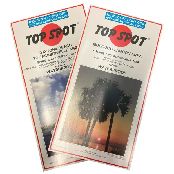
Map N219 runs from the North Indian River to the North and South Mosquito Lagoon.
Map N221 runs from Daytona Beach to Jacksonville, including Ponce Inlet, Halifax River, Matanzas Inlet, Matanzas River, St. Augustine Inlet, and Mayport Inlet.
| Brand | Misc |
|---|---|
| Year | 2017 |